You may have heard about the mystical beauty of Ha Giang and the warmness that comes from the local customs and people, but you might be unsure of where to go and what this place has to offer. Here is some information that Loka Ha Giang has been total about the Ha Giang Loop Map that will help you plan your next trip in a detailed and exciting way.
Where is Ha Giang Loop located?

Ha Giang is located in Vietnam, within and around the city of Ha Giang, approximately 300 km away from the capital city of Hanoi. Ha Giang Loop is an enticing motorbike journey that takes travelers through stunning landscapes including limestone formations, rice fields, and traditional villages of various ethnic groups. With a main distance of around 350 km, the loop can be completed in 3 days (however, if you wish to have a slower-paced experience in more rural areas, it’s recommended to allocate more time).
Ha Giang Loop map
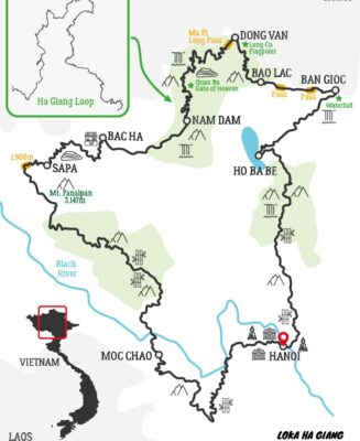
The map below will help you have a better understanding of Ha Giang Loop.
TAM SON – YEN MINH (51 KM):
From the top of Heaven’s Gate, you can enjoy a panoramic view of Tam Son town. It appears like traces of clouds in the sky with vast pine forests spreading on numerous slopes as we ride through Can Ty Pass to Yen Minh town. Yen Minh town is an ideal place for travelers to rest and have a meal along the way.
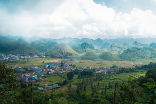
HA GIANG CITY – TAM SON TOWN (45 KM)
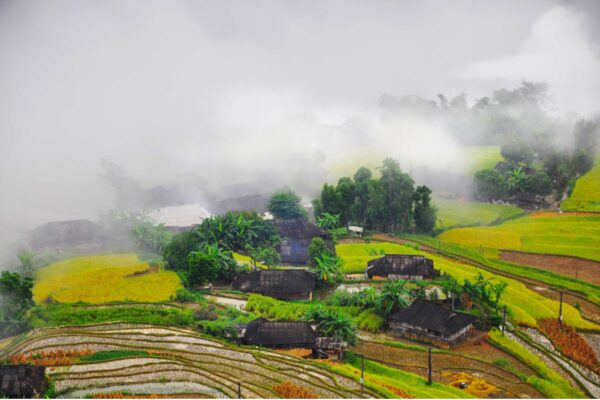
The city of Ha Giang serves as a hub with a wide selection of guesthouses and hostels where you can rest before and after your journey. Additionally, there are several nearby attractions worth exploring, such as Nui Cam Mountain and the Thon Tha village of the Tay ethnic group. As you travel from there to Tam Son town at the end of Quan Ba Pass, you will experience the contrast between the city and the higher regions, with a rustic and chilly atmosphere passing through Nam Dan Village, Twin Mountain, and Lung Khuy Cave. Every Saturday, there is a large market gathering 22 ethnic minority groups.
YEN MINH – DONG VAN (46 KM)
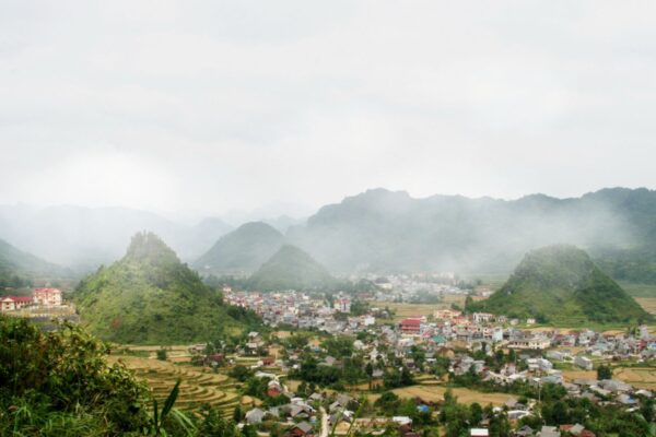
Embark on an extraordinary journey as you conquer the magnificent Tham Ma and Chin Khoanh mountain passes, where you’ll be captivated by breathtaking vistas. Don’t miss the opportunity to visit the Cultural Village and Tourism Area of Lung Cam, adorned with vibrant traditional costumes and floral arrangements adorning the locals. Here, you’ll delve deeper into the distinctive architecture and rich history of the region as you explore the H’Mong Palace and ancient houses in Pho Bang. Be sure to visit the Lung Cu Flag Tower, a remarkable landmark marking the northernmost point, offering a tranquil retreat and a serene atmosphere. At night, the town of Co Dong Van comes to life, separate from the bustling areas, where it is home to thousands of residents and holds countless stories spanning over a century. Indulge in the region’s diverse and plentiful specialties that are guaranteed to satisfy your taste buds.
DONG VAN – MEO VAC (22 KM) – DONG VAN – DU GIA (72 KM)
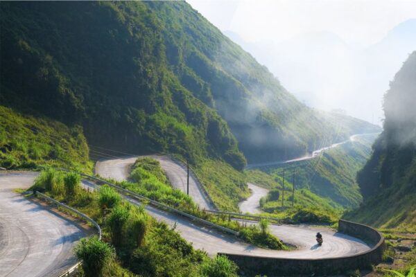
The Ma Pi Leng Pass on the Hanh Phuc Road of Highway 4C, with an altitude of 1,500 meters above sea level, connects Dong Van and Meo Vac. This captivating landscape attracts adventure enthusiasts with its winding and steep mountain roads. Looking down at the astonishing cliffs, the Nho Que River, and the Tu San mountain pass, they appear charming like vibrant notes in a magnificent symphony. In Meo Vac, particularly in the Mau Dua and Du Gia areas, the road takes on a wilder character with simple houses and terraced green fields nestled against rugged mountains. The valleys captivate with vibrant scenery while gentle cascades of water adorn the landscape. A fantastic idea is to immerse yourself in delicious local cuisine and the joyful atmosphere at night, or delve into the traditional customs of the region, such as the exquisite handicrafts in Lung Tam village.
The Ha Giang Loop is a unique adventure that allows travelers to immerse themselves in the natural beauty and rich cultural heritage of Ha Giang province. The journey takes visitors through stunning landscapes, ethnic minority communities, and famous attractions such as the Mã Pì Lèng Pass. By following the Ha Giang Loop map, travelers can navigate the route easily and maximize their exploration. Whether it’s terraced fields, towering mountains, or the hospitality and generosity of the local people, the Ha Giang Loop promises an unforgettable experience at the heart of Northern Vietnam.

My name is Giap Van Hai, I am a travel enthusiast and always want to share the beauty of Ha Giang with everyone. With a deep love for the mountains and the typical culture of Ha Giang people, I decided to establish Loka Ha Giang – a website specializing in Ha Giang tourism services. We provide travel services such as Ha Giang Loop, Ha Giang Trekking, Ha Giang Easyrider